Sunday, January 5, 2020
Sunday, April 8, 2018
Shallow water
For manoeuvring purposes, the depth less than twice the draft of the vessel is considered to be shallow water.
Now, you must be wondering why so?
It is because at this depth, the seabed causes a drag on the vessel, which changes it’s manoeuvring characteristics.
Now, that we have understood what is shallow water, let us see and understand what are it’se effectson the ship:
As the vessel enters shallow waters, the vibration throughout the ship increases. This is because the hull vibration almost matches with the engine vibrations.
The bow waves increases, which increases the load on the engine. Hence the ship’s speed should be reduced.
Appearance of muddy water at the stern part of the vessel.
Vessel’s turning circle increases. It increases by as much as 3 times than in the deep waters.
Directional stability of the vessel increases. Directional stability means the ability to maintain a
single heading, i.e. it requires more helm to change the vessel’s heading.
The steering of the vessel becomes sluggish as compared to that in deep waters.
Pivot point of the vessel shifts a little bit aft, about 1/3rd of ship’s length from bow. This is the
reason for vessel’s steering being sluggish.
Squat increases. Squat is defined as reduction in UKC as the vessel moves through the water.
Stopping distance increases when astern movement is given. Although propeller is moving
astern but there is a void space in astern and there is not enough water for griping, hence
resulting in increase of the stopping distance.
Thursday, April 5, 2018
GNSS

GNSS
It may be a bit unexpected, but many of the plans that will change GPS as a practical utility will be implemented entirely outside of the GPS system itself. The GPS system is one component of the worldwide effort known as the Global Navigation Satellite System (GNSS). Another component of GNSS is the GLONASS system of the Russian Federation, and a third is the Galileo system administered by the EU. And it is likely that more constellations will be included in GNSS, such as the Japanese Quasi-Zenith Satellite System (QZSS), the Indian Regional Navigation Satellite System (IRNSS) and the Chinese BeiDou Satellite Navigation and Positioning System. They will be augmented by both ground-based augmentation systems (GBAS) and space-based augmentation systems (SBAS) deployed by the United States, Europe, Japan, China, and Australia. One immediate effect of GNSS is the substantial growth of the available constellation of satellites; the more signals that are available for positioning and navigation, the better. The concept is that these networks of satellites and others will begin to work together to provide positioning, navigation, and timing solutions to users around the world.
As you see here, there are three constellations that are probably most on our minds. GPS, of course, is the foundation of our satellite navigation in North America. GLONASS is the Russian system. It has some similarities, some differences with GPS. Galileo is the European Union system.
As you see right here in this illustration, there are some obvious differences between the systems. GPS, six orbital planes; Galileo, three; and GLONASS, three. The number of satellites really is somewhat consistent in each case. The inclination angle is 55 degrees for GPS; 56 degrees for Galileo, 64.8 degrees for GLONASS. The altitudes are similar. GPS in the middle and Galileo somewhat higher and GLONASS somewhat lower.
The objectives are cooperation, interoperability, and compatibility. Interoperability is the idea that properly equipped receivers will be able to obtain useful signals from all available satellites in all the constellations and have their solutions improved rather than impeded by the various configurations of the different satellite broadcasts. Further, they will be augmented by both ground-based augmentation systems, GBAS, and space-based augmentation systems, SBAS, to provide positioning, navigation and timing solutions to users around the world. Compatibility refers to the ability of U.S. and foreign space-based positioning, navigation, and timing services to be used separately or together without interfering with use of each individual service or signal. The two systems that are fully operational are GPS and GLONASS.

the International GNSS Service (IGS) is a service of the International Association of Geodesy and the Federation of Astronomical and Geophysical Data Analysis Services that was originally established in 1993. Like NGS, IGS also provides CORS data. However, it has a global scope. The information on the individual stations can be accessed including the ITRF00 Cartesian coordinates and velocities for the IGS sites, but not all the sites are available from IGS servers. One example of the scope of this increased horizon in global positioning is illustrated by the name change of the International GPS Service to the International GNSS service, IGS.
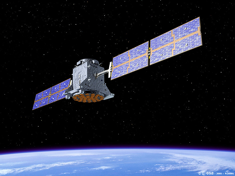
Galileo Satellite
One immediate effect of GNSS is the substantial growth of the available constellation of satellites; the more signals that are available for positioning and navigation, the better. The concept is that these networks of satellites and others will begin to work together to provide positioning, navigation, and timing solutions to users around the world.
DGPS

DGPS
The term DGPS is sometimes used to refer to differential GPS that is based on pseudoranges, aka code phase. Even though the accuracy of code phase applications was given a boost with the elimination of Selective Availability (SA) in May 2000, consistent accuracy better than the 2-5 meter range still requires reduction of the effect of correlated ephemeris and atmospheric errors by differential corrections. Though the corrections could be applied in post-processing services that supply these corrections, most often operate in real-time. In such an operation, pseudorange based versions can offer meter- or even submeter results.
Usually, pseudorange corrections are broadcast from the base to the rover or rovers for each satellite in the visible constellation. Rovers with an appropriate input/output (I/O) port can receive the correction signal and calculate coordinates. The real-time signal comes to the receiver over a data link. It can originate at a project specific base station, or it can come to the user through a service of which there are various categories. Some are open to all users, and some are by subscription only. Coverage depends on the spacing of the beacons, aka transmitting base stations, their power, interference, and so forth. Some systems require two-way, some one-way, communication with the base stations. Radio systems, geostationary satellites, low-earth-orbiting satellites and cellular phones are some of the options available for two-way data communication. In any case, most of the wide variety of DGPS services were not originally set up to augment surveying and mapping applications of GPS; they were established to aid GPS navigation.
DGPS is a term most often used for this kind of arrangement with pseudo-ranges or code phase as we discussed earlier. This is typically not a carrier solution.
If you think... you can.
IF you can keep your head,
When all about you are losing theirs
if you can trust yourself
when all men doubt you
but make allowances for their doubting too
if you can make one heap of all your
winning and risk it on one
turn of pitch-and-toss
lose,and start again at your beginning
if you can dream and not makes dreams
your master.
if you can walk with crowds and
keep your virtue
or walk with kings, nor lose the
common touch
if you can fill the unforgiving minute
with sixty seconds worths of distance run,
your is the earth and everything
that's in it, and- which is more-
YOU WILL BE A MAN
Deferential and Relative GPS (Carrier Phase vs. Code Phase)
Differential Correction
Carrier Phase vs. Code Phase
100 meter accuracy can improve to between 5 meters and sub-meter depending on the data collection technique and the data receiver used. Differential correction is a data collection technique that removes errors in GPS data created by selective availability and other factors. Some of the other factors that create error in GPS data include:
multipath
low number of visible satellites
large distance between the rover and the base station (10mm degradation with every kilometer away from base station)
high PDOP (position dilution of precision- a measure of the current satellite geometry)
low SNR (signal to noise ratio)
low satellite elevation
short occupation period
Pathfinder Office software comes with a differential correction utility that calculates error at a known point (base station) and uses this error to correct (or improve the accuracy of) the rover file data you collected with your GPS unit.
Code phase is one processing technique that gathers data via a C/A (coarse acquisition) code receiver, which uses the information contained in the satellite signals (aka the pseudo-random code) to calculate positions. After differential correction, this processing technique results in 1-5 meter accuracy. (If more than 180 position records are recorded, the average will be within 1 meter.)
Carrier phase is another processing technique that gathers data via a carrier phase receiver, which uses the radio signal (aka carrier signal) to calculate positions. The carrier signal, which has a much higher frequency than the pseudo-random code, is more accurate than using the pseudo-random code alone. The pseudo-random code narrows the reference then the carrier code narrows the reference even more. After differential correction, this processing technique results in sub-meter accuracy.
The carrier phase receivers are much more accurate than C/A code receivers, but require more involved post-processing and stricter data collection requirements. Carrier phase receivers (survey grade) require a clear view to the satellites in order to maintain a constant lock with at least 4 satellites, while C/A code receivers (mapping grade) do not need to maintain a constant lock with the satellites to calculate positions. This makes a C/A code receiver imperative to gathering data in adverse conditions (for example, under trees). Once you have achieved carrier time (set in your GPS configuration) and you have stored the information, your data can be differentially corrected with carrier phase processing. To ensure that the carrier lock is never lost, once carrier time has been achieved and you save the rover file, a new rover file must be created for each subsequent carrier session. Although it is more difficult to gather carrier code data than solely pseudo-random code, accuracy is increased from 3-5 meter accuracy to sub-meter accuracy.
In Short:
Code phase processing- GPS measurements based on the pseudo random code (C/A or P) as opposed to the carrier of that code. (1-5 meter accuracy)
Carrier phase processing- GPS measurements based on the L1 or L2 carrier signal. (sub-meter accuracy)
Carrier- A signal that can be varied from a known reference by modulation.
Code-Phase GPS vs. Carrier-Phase GPS
The words "Code-Phase" and "Carrier-Phase" may sound like electronic mumbo-jumbo but, in fact, they just refer to the particular signal that we use for timing measurements. Using the GPS carrier frequency can significantly improve the accuracy of GPS.
The concept is simple but to understand it let's review a few basic principles of GPS.
Remember that a GPS receiver determines the travel time of a signal from a satellite by comparing the "pseudo random code" it's generating, with an identical code in the signal from the satellite.
The receiver slides its code later and later in time until it syncs up with the satellite's code. The amount it has to slide the code is equal to the signal's travel time.
The problem is that the bits (or cycles) of the pseudo random code are so wide that even if you do get synced up there's still plenty of slop.
Consider these two signals: (image not included)
If you compared them logically you'd say they matched. When signal A is a one, signal B is a one. When signal A is a zero, signal B is a zero.
But you can see that while they match they're a little out of phase. Notice that signal A is a little ahead of signal B. In fact you could slide signal A almost a half a cycle ahead and the signals would still match logically.
That's the problem with code-phase GPS. It's comparing pseudo random codes that have a cycle width of almost a microsecond. And at the speed of light a microsecond is almost 300 meters of error!
Code-phase GPS isn't really that bad because receiver designers have come up with ways to make sure that the signals are almost perfectly in phase. Good machines get with in a percent or two. But that's still at least 3-6 meters of error.
Take it to a higher (frequency) authority: (image not included)
Survey receivers beat the system by starting with the pseudo random code and then move on to measurements based on the carrier frequency for that code. This carrier frequency is much higher so its pulses are much closer together and therefore more accurate.
If you're rusty on the subject of carrier frequencies consider your car radio. When you tune to 94.7 on the dial you're locking on to a carrier frequency that's 94.7 MHz.
Obviously we can't hear sounds at 94 million cycles a second. The music we hear is a modulation (or change) in this carrier frequency. So when you hear someone sing an "A" note on the radio you're actually hearing the 94.7 MHz carrier frequency being varied at a 440 cycle rate.
GPS works in the same way. The pseudo random code has a bit rate of about 1 MHz but its carrier frequency has a cycle rate of over a GHz (which is 1000 times faster!)
At the speed of light the 1.57 GHz GPS signal has a wavelength of roughly twenty centimeters, so the carrier signal can act as a much more accurate reference than the pseudo random code by itself. And if we can get to within one percent of perfect phase like we do with code-phase receivers we'd have 3 or 4 millimeter accuracy! Yeeow!
Catching the Right Wave (image not included)
In essence this method is counting the exact number of carrier cycles between the satellite and the receiver.
The problem is that the carrier frequency is hard to count because it's so uniform. Every cycle looks like every other. The pseudo random code on the other hand is intentionally complex to make it easier to know which cycle you're looking at.
So the trick with "carrier-phase GPS" is to use code-phase techniques to get close. If the code measurement can be made accurate to say, a meter, then we only have a few wavelengths of carrier to consider as we try to determine which cycle really marks the edge of our timing pulse.
Resolving this "carrier phase ambiguity" for just a few cycles is a much more tractable problem and as the computers inside the receivers get smarter and smarter it's becoming possible to make this kind of measurement without all the ritual that surveyors go through.
Terminology:
These terms and others are found at: http://www.trimble.com/gps/nfsections/aa_gls.htm
Carrier phase- GPS measurements based on the L1 or L2 carrier signal.
Carrier- A signal that can be varied from a known reference by modulation.
Code phase GPS- GPS measurements based on the pseudo random code (C/A or P) as opposed to the carrier of that code.
L-band- The group of radio frequencies extending from 390 MHz to 1550 MHz. The GPS carrier frequencies (1227.6 MHz and 1575.42 MHz) are in the L band GPS Signals in detail
Pseudo random code- A signal with random noise-like properties. It is a very complicated but repeating pattern of 1's and O's.
Pseudorange- A distance measurement based on the correlation of a satellite transmitted code and the local receiver's reference code, that has not been corrected for errors in synchronization between the transmitter's clock and the receiver's clock.
Carriers- The GPS satellites transmit signals on two carrier frequencies. The L1 carrier is 1575.42 MHz and carries both the status message and a pseudo-random code for timing. The L2 carrier is 1227.60 MHz and is used for the more precise military pseudo-random code.
Pseudo-Random Codes- There are two types of pseudo-random code (see tutorial for explanation of pseudo random codes in general). The first pseudo-random code is called the C/A (Coarse Acquisition) code. It modulates the L1 carrier. It repeats every 1023 bits and modulates at a 1MHz rate. Each satellite has a unique pseudo-random code. The C/A code is the basis for civilian GPS use. The second pseudo-random code is called the P (Precise) code. It repeats on a seven day cycle and modulates both the L1 and L2 carriers at a 10MHz rate. This code is intended for military users and can be encrypted. When it's encrypted it's called "Y" code. Since P code is more complicated than C/A it's more difficult for receivers to acquire. That's why many military receivers start by acquiring the C/A code first and then move on to P code.
Navigation Message- There is a low frequency signal added to the L1 codes that gives information about the satellite's orbits, their clock corrections and other system status.
The following can be found at: http://www.trimble.com/gps/howgps/page11.htm
A Random Code? The Pseudo Random Code (PRC) is a fundamental part of GPS. Physically it's just a very complicated digital code, or in other words, a complicated sequence of "on" and "off" pulses as shown here: (image not included)
The signal is so complicated that it almost looks like random electrical noise. Hence the name "Pseudo-Random". There are several good reasons for that complexity: First, the complex pattern helps make sure that the receiver doesn't accidentally sync up to some other signal. The patterns are so complex that it's highly unlikely that a stray signal will have exactly the same shape.
Since each satellite has its own unique Pseudo-Random Code this complexity also guarantees that the receiver won't accidentally pick up another satellite's signal. So all the satellites can use the same frequency without jamming each other. And it makes it more difficult for a hostile force to jam the system. In fact the Pseudo Random Code gives the DoD a way to control access to the system. But there's another reason for the complexity of the Pseudo Random Code, a reason that's crucial to making GPS economical.
The codes make it possible to use "information theory" to "amplify" the GPS signal. And that's why GPS receivers don't need big satellite dishes to receive the GPS signals.
The following can be found at: http://www.trimble.com/gps/diffgps/gpsfram1.htm
Why do we need Differential GPS?
Basic GPS is the most accurate radio-based navigation system ever developed. And for many applications it's plenty accurate. But it's human nature to want MORE!
So some crafty engineers came up with "Differential GPS," a way to correct the various inaccuracies in the GPS system, pushing its accuracy even further.
Differential GPS or "DGPS" can yield measurements good to a couple of meters in moving applications and even better in stationary situations.
That improved accuracy has a profound effect on the importance of GPS as a resource. With it, GPS becomes more than just a system for navigating boats and planes around the world. It becomes a universal measurement system capable of positioning things on a very precise scale.
The solution: reference receiver measures errors. That's the key to differential. We have one receiver measure the timing errors and then provide correction information to the other receivers that are roving around. That way virtually all errors can be eliminated from the system, even the pesky Selective Availability error that the DoD puts in on purpose.
Thursday, August 27, 2009
Use your wristwatch as a compass

If you have an analog wrist watch, you can use the time to find north. Hold your watch up in front of you, and let the short hand, red on the figure, that indicates hours point at the sun. While holding it like this, cut the angle between the red arrow and 12 o'clock in two, (noonwards if the time is before 6am or after 6pm), that way is south. (The reason you need to cut it in two, is because the clock takes two rotations while the sun takes one around the earth, it is of course the other way around, but never mind.)
Many people wear digital watches these days (I do myself, if I wear one at all). If you do, draw an analog watch face on a piece of paper, and then mark the hour hand on using the digital watch. The rest of the method is identical.
This method can be used even when it is pretty foggy. Although you may not be able to see the sun, it may still cast a shadow. If you take up a straw or a tiny stick, and you may see a shadow. You just have to remember that the shadow points the opposite way from the sun, but the rest of it is quite similar as above.
Subscribe to:
Posts (Atom)


